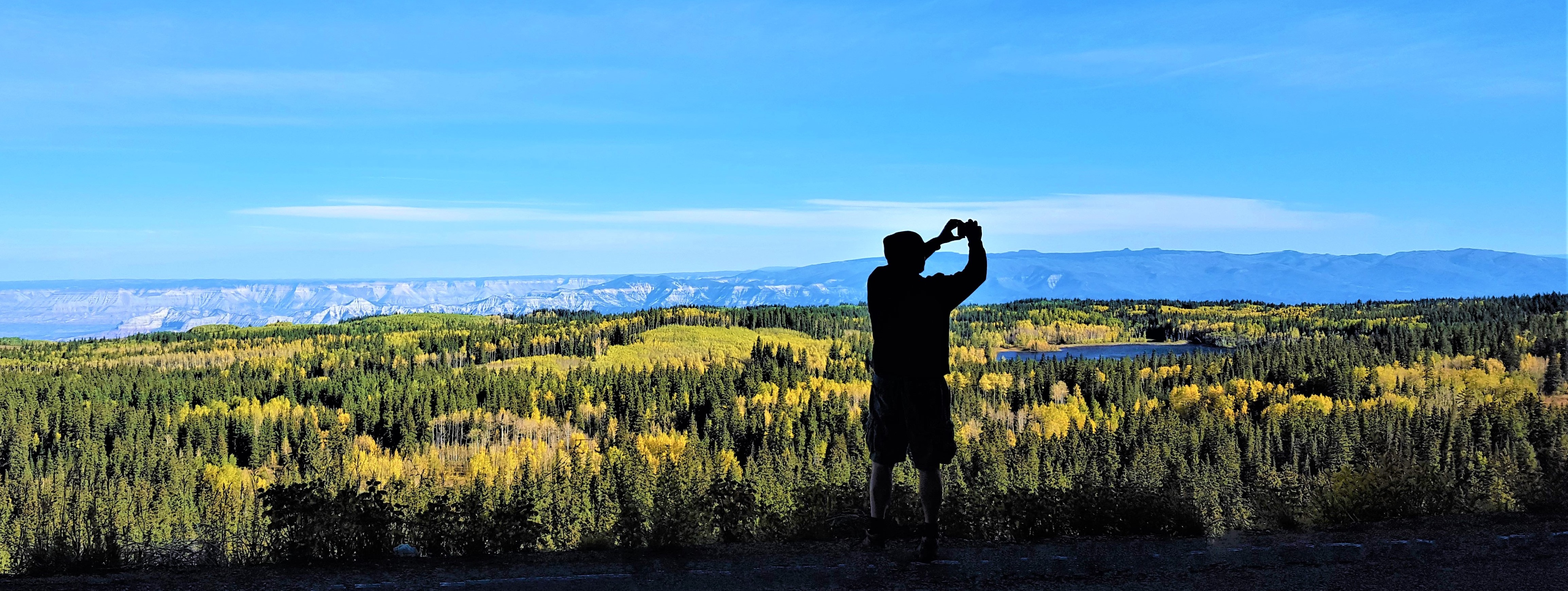
Colorado Overland Photo Safari
A scenic journey into the heart of Colorado, inspired by the book Blue Highways, actuated by an amazing dog.
This route is our easiest and longest, with the most varied terrain and degrees of solitude. We completed the basic loop in five days, but it could have easily been double that. This journey was designed for a friend and his photographer wife that lived too far to bring thier own rig to Colorado; the plan was to fly into DIA, rent a stock 4Runner or Wrangler, pick up some basic camping gear and go Overlanding without (hopefully) damaging the vehicle.
We had a book in common, Blue Highways by William Least Heat Moon which became part of the inspiration for this route, but with a twist; instead of focusing on local cuisine like the book, he and his wife wanted to see “local” Colorado; quiet places that aren’t in vacation guides or popular on social media, places where time has stood still and history can be seen and felt. This route is largely dirt roads and “blue highways” leading to excellent adventures, unique photo opportunities, great camping, historic places and really good pie in Paonia. We nicknamed it the “dirty road trip” because it’s more of a road trip featuring dirt roads than an offroad challenge. It’s designed to be an easy route, so much so that I never thought I would run it myself. I saved it and forgot about it. Our friends never ran it either, it remained a concept until a few years later when a last minute change of mind led to one of the best decisions of my life.
We went to the shelter looking for a puppy but ended up adopting an 11 year old, 107 lb. Australian Shepherd / Great Pyrenees mix that had lived his life outside in a small pen, had untreated medical conditions, was deaf, scared in general and afraid of men specifically. There was something about him though, I felt him from the moment I saw him. He was sweet and kind, he liked our cats, and loved walks; everything was new and interesting to him, but he remained stressed out and riding in the back of our Xterra was the only time he truly relaxed. I’m not sure he had ever been in a vehicle before and it seemed to hypnotize him, he would stare out the window smiling and often drift off to sleep. My wife suggested we take him on a long road trip to help him relax and see some of the beautiful state he lived in. I remembered this route, found the planning files on an old laptop and we set off a few days later to run it. It was epic for us, I loved this adventure from beginning to end. We connected and bonded with him, saw Colorado through his eyes and made memories that will last for our lifetimes. He was with us for 32 months until his passing, they were some of the best days of my life.
Technical:
Start Point: Empire
End Point: Georgetown
Total Mileage: 750+/-
Difficulty: Easy
Highest Elevation: 12,074
Season Travelled: Fall
Permits Required For: n/a
Delorme Atlas & Gazeteer™ Colorado (in order of route):
Section One: p. 39, 38, 28, 27, 37, 36, 35, 34, 45 & 44
Section Two: p. 44, 43, 55, 56, 66, 67, 57, 56, 45, 46 & 47
Section Three: p. 60, 47, 48, 49 & 39
Camping:
There are too many options for both Dispersed
and Established camping along this route to list.
Some favorites include:
Crooked Creek / Keyser Creek
Williams Fork Reservoir
Coffee Pot Road
Grand Mesa
Fourmile Area
Weston Pass
Individual Whole Road Video Links:
Section One: Empire to Grand Mesa:
Aprox. 225 Miles plus stops. This section is largely dirt roads with various historical photo stops. It’s the “Dirty Blue Highways” section, much of it is remote and quiet.
Highway 40 -we took I-70 West out of Denver to exit 232, Empire. The .GPX starts just past Empire by Berthod Falls. This area is busy during ski season but much quieter other times of the year. The driving is easy and fast with incredible views around every turn. Our first major photo stop is on the outskirts of Winter Park, the abandoned Train Trestles of Moffat Road.
CR80 / FR149 / Moffat Road -the first major photo detour on this route is one of the best. The drive is short, just a few miles to the hiking trailhead at 11,660 ft. Along the way there are two beautiful old trestles to see, views of the Winter Park Ski Area, dispersed camping, hiking trails and lots of gorgeous Colorado scenery. At the top is the Continental Divide and the short hike to the Needles Eye Tunnel along the old railroad tracks. The railroad tracks are gone, recycled for WWII, but you cross over two old trestles to get to the tunnel (and again on the way back). The trestles are a bit scary but the views and photo opportunities were worth it for us. Check them out in the video.
CR50 / Crooked Creek -about 5 miles north of Moffat road is the small town of Fraser where we turned west on CO 73 to CR50 Crooked Creek. This is an easy, graded dirt road with a few residences at the start and then it’s a quiet drive in the woods with fantastic views and wildlife. Watch out for bicycles here.
FR139 / Keyser Creek Road -another easy graded dirt road with a lot of large dispersed campsites that can accommodate trailers. The road drops down to parallel Keyser Creek all the way to the Williams Fork River, with a few dispersed campsites and the excellent established Horseshoe Campground at the end.
CR3/ Upper Williams Fork Road -a peaceful wide dirt highway through an unexpected part of Colorado. It looks a lot like the western deserts here until we reach the Williams Fork Reservoir.
CR33 / River Drive -this road winds around the Williams Fork Reservoir after we take a quick lap through the reservoir roads. We were slowed down briefly in a herd of cows on the road which was so much fun. The whole area is just stunning, we ended up camping at the reservoir on another trip after seeing it this time. Great little corner of Colorado.
CR1 / Trough Road -one of my favorite dirt roads in Colorado, and one of six highlight roads on this trip. You can see the whole road here Trough Road. This is the kind of road you lose yourself on; its quiet, easy and the scenery never stops. The only paved section comes when you reach the Gore Canyon Overlook. It’s just a mile or so of pavement, but the road was undriveable in bad weather through that stretch before it was paved. The overlook is excellent, as are the views for the entire road.
Highway 131 -eight miles of peaceful blue highway, just a brief connector between two of the highlight roads of this route.
CR301 / Colorado River Road -another highlight road, you can see the whole road here Colorado River Road. Much of this road goes by the Colorado River Ranch, a generations old operation that looks like it fell out of a history book. There are many old structures, hayfields and grazing areas on one side, and often the Colorado River on the other. Train tracks parallel the road for quite a bit of it, and if you’re lucky enough you might drive next to a train. It’s an experience! The Colorado River Ranch is so big and has been here so long that they have their own historic school house you can stop at. We also stopped at Red Dirt Open Space, a lovely short trail along the water leading to a small park. Further down is Coffee Pot Road; this is an alternative route to Glenwood Springs from here that we did not take on this trip. We drove this in our stock Xterra and Transfer Trail is a legit 4×4 trail that would test it’s capabilites, especially travelling solo. Not the smart choice for this trip, but an excellent alternative for a well equipped group. We continued on to the amazing Glenwood Canyon.
Interstate 70 -I usually avoid I-70 and I-25 like the plagues they are, but this particular stretch is special. There is a documentary on Rocky Mountain PBS about the construction of the highway going through Glenwood Canyon, it is just gorgeous. We, however, managed to go through it during construction and the quick 37 miles of interstate took much longer than expected. Morpheus told us the freeway was suicide.
Silt / Colbran Road -the third highlight road in this section, see the whole thing here Silt-Collbran Road. This is actually a string of roads with various names and occasional signs, but there are simple signs at each intersection pointing you to Collbran. There is a cool church along the way and landscape scenery that is second to none. You can see Grand Mesa as you enter the White River National Forest, and the road changes from pavement to dirt to bentonite (bentonite is undriveable when wet!) as it enters the Grand Mesa National Forest. Even the signs for the forests are picture worthy, this is real Colorado at it’s finest. The road ends in the small, charming town of Collbran, our gateway to the wonders of Colorado’s Grand Mesa.
Section Two: Grand Mesa to Twin Lakes:
Aprox. 350 Miles plus stops. This section begins with epic dirt roads full of history and incredible scenery and continues on some true Blue Highways with multiple photo stops and two stops for pie. It’s the real Blue Highways section, with peaceful backroads and easy drives.
58 1/2 Road / NE Road / 59 Road / CR121 -this is the road sequence from Collbran to the Grand Mesa Forest, but just like Silt-Collbran road you can just follow the signs to Grand Mesa. The 1/2 road is not a mistake, roads in western Colorado often have fractional designations. I guess they could have planned better, but it’s more fun this way. Largely easy dirt roads, the final ascent to Grand Mesa is especially pretty. Grand Mesa is one of the prettiest places on planet earth, and this section is a great introduction to that.
CR121 / Lakeshore Drive -if you ever wondered what the USA looked like in the 1950s take a look at Lakeshore drive. Development is limited to none here, it’s just small cabins and a couple of lodges along lake after lake. If Grand Mesa isn’t heaven it’s in the same zip code.
Highway 65 Grand Mesa Scenic Highway -this is the main road over Grand Mesa and it is a really scenic highway. We started it from the Grand Mesa Visitor Center which is absolutely worth stopping at. There are various camping and day use areas along this road, every single one is worth seeing. There are even some cool dirt roads near some of the lakes that could qualify as moderate 4×4 trails, especially if it’s been raining.
CR100 / Lands End Road -wow. The best road on Grand Mesa, IMO. See the whole road here Lands End Road. First we stopped at the Raber Cow Camp, a couple of old buildings with kiosks too weathered to read and walkways that are being reclaimed by the mesa. Neat stop. At the edge of the Mesa is the Lands End Observatory, a formidable stone structure with flagstone walkways and overlooks along the edge of the mesa that give you world class views into Utah the the La Sals, Moab and beyond. As amazing as all that is, the real treat comes after the Observatory: the switchbacks of Lands End Road that drop down the side of the mesa for over 4500 feet. This road surface is flat and level, but it is a shelf and the first few miles can be intimidating. The views are insane the entire way, we couldn’t get enough of it and it felt like it ended too soon. At the bottom it connects to Kannah Creek road in a residential area, which ends at HWY 50.
Highway 50 -we take this all the way to Blue Mesa Reservoir through a few cool small towns, it’s a fast and mellow drive with a lot to see along the way. A real Blue Highway. The original purpose for going this way was to access the Black Canyon of the Gunnison National Park from the south side and again from the north entrance highway 92 for photographs. Our dog was not up for the hiking that day so we rented a boat at Blue Mesa Reservoir instead. BCGNP would be a great addition to this route, and camping on the north side of the park would have been my choice on a different day.
Escalante Canyon Road -this area is all about history and beauty. Just a few miles from Grand Mesa we detoured off highway 50 for a couple of hours. There are two historic cabins with kiosks and surprises, pictographs, remnants of cowboy culture and the awesome Potholes swimming area. This is a real hidden gem of an area, keep it between us.
Highway 92 -one of Colorado’s most beautiful paved roads follows the Gunnision River for a while and drifts through sleepy small towns as it winds up north. There are a few stops along the way, we stopped at Pioneer Point and Hermits Rest, both of which offer stunning views of the Gunnision River and Canyon. This road is popular with motorcycles and is especially lovely in the fall when the leaves are changing. Before heading up we rented a boat at Blue Mesa Reservoir and photographed the Dillon Pinnacles from the water. I don’t regret it, but that decision cost us precious time that we paid for later on by arriving at Twin Lakes in the dark.
Highway 133 -it’s pie time! This area is transitioning from mining to agriculture and the results are delicious. We stopped at Big B’s Delicious Orchards for possibly the best Cherry Pie I’ve ever had. We detour to the magical town of Marble to see the Marble Mill Site Park, a place that produced much of the marble in our state capital and in Washington DC until it was closed and abandoned with much of the marble and machinery still in place. The town turned it into a park, and it’s one of the most unique parks I’ve ever seen. There is marble and the remains of marble structure all along some pretty trails in a wooded setting. The photo ops are everywhere. Also in Marble is the amazing Slow Groovin’ BBQ. It’s the only restaurant, to find it go to the main road. If you don’t see it go the other way. Seriously, the town is that small, those are the directions, or you can just follow your nose. Further up highway 133 is a stop for Hays Creek Falls that is better in the spring when water is flowing heavily. Past that are the Redstone Coke Ovens, a remnant of the heyday of mining in the area. They are pretty little behive brick ovens that super heated coal to convert it to coke. In the 60s hippies lived in them. They’re right along the road and a very interesting. There are kiosks and a mining memorial as well. Across the road the little town of Redstone is almost too perfect, passionate residents keep it that way. Great coffee and pastries in Redstone, nice people too.
Highway 82 -this takes us from Carbondale to Aspen and becomes Independence Pass road. Carbondale and Aspen are modern towns near the interstate. There isn’t much to stop for here, but it is a nice drive. After Aspen the road changes to a narrow shelf road that winds up over Independence Pass and features the ghost town of Independence. The ghost town is maintained by the Aspen Historical Society and is just wonderful. Lots of old structures in a postcard setting, you could spend a day taking pics here. The road ends at the intersection with highway 24 at Twin Lakes. These lakes are so stunning that even I got good pics there, a real photographer would have a field day. We screwed up our schedule with an unexpected boat rental earlier in the day and got here in the dark so the pics in the video are from the next day. That’s how overlanding goes…
Section Three: Buena Vista to Georgetown:
Aprox. 120 Miles plus stops. This section goes over the top of the world on beautiful mountain passes to the end of the route in Georgetown. It’s the chill section, we spent a lot of it roaming around Weston Pass and wishing it wouldn’t end.
Fourmile Area -on the eastern edge of Buena Vista is a little chunk of overland heaven called Fourmile. It’s a network of easy but fun 4×4 roads with a ton of dispersed campsites, each better than the last. We found a great site off 376A with views of the Collegiate Peaks and spent two nights there camping, hiking, cooking and mostly not driving. I have a video about this area here FOURMILE. There is a lot to do there and Fourmile is a great basecamp. It’s just a few hours from my home in Denver, I use it as a testing ground for camping equipment and such when I can. In the fall it’s popular for leaf peeping. You could easily spend a week exploring this area and the surrounding ones.
Highway 24 -a peaceful Blue Highway that took us from Buena Vista back past Twin Lakes and up to Weston Pass. Buena Vista has some good food and coffee, and we got some excellent photos at Twin Lakes on the way up to Weston.
CR7 / CR22 / CR5 Weston Pass Road -Weston Pass makes it’s way into almost every route that is plotted through central Colorado, and with good reason. It is one of the highlights of this route, you can see the whole road here Weston Pass. It was the second place I ever camped in Colorado, everyone kept recommending it, and with good reason. We took it slow on our last day of this trip and spent a few hours just east of the pass in a small network of easy roads just walking around, hanging out, eating and experiencing the world. It feels like you’re on top of the world here in every way possible.
Highway 285 -this is like a major Blue Highway; still quiet and just one lane each way for the most part, but the speed limit goes up to 75 which feels like you’re flying after all the dirt roads up to here. We passed through a few cool small towns and went over stunning Kenosha Pass with a stop at the South Park lookout until we reached Grant and the turn off for Guanella Pass. There is a business in Grant that restores International Scouts and they have some unique ones parked outside; my first 4×4 was a rusted out Scout, I had to stop.
CR62 / Geneva Road / Guanella Pass Road -the last pass of this trip, Guanella Pass is a Colorado classic. You can see the whole road here Guanella Pass. Epic hiking and 4×4 trails start from this road, as well as many day use areas with exceptional views and photo ops all along the way. The road ends in historic Georgetown, which also marks the end of this route.
If you’d like to support this site please subscribe to our channel on youtube
Copyright © 2024 All Rights Reserved
All materials on this site are protected by copyright and intellectual property laws and are the property of the Author. You may not reproduce this material on your personal website, blog, social network, or any other online, offline, digital or print resource without permission.
You may only access and download the materials located on ColoradoOverlandRoutes.com for personal, non-commercial use.
