LOS PINOS
Backroads to the Alpine Loop Section Two: Monarch Pass to Lake City.
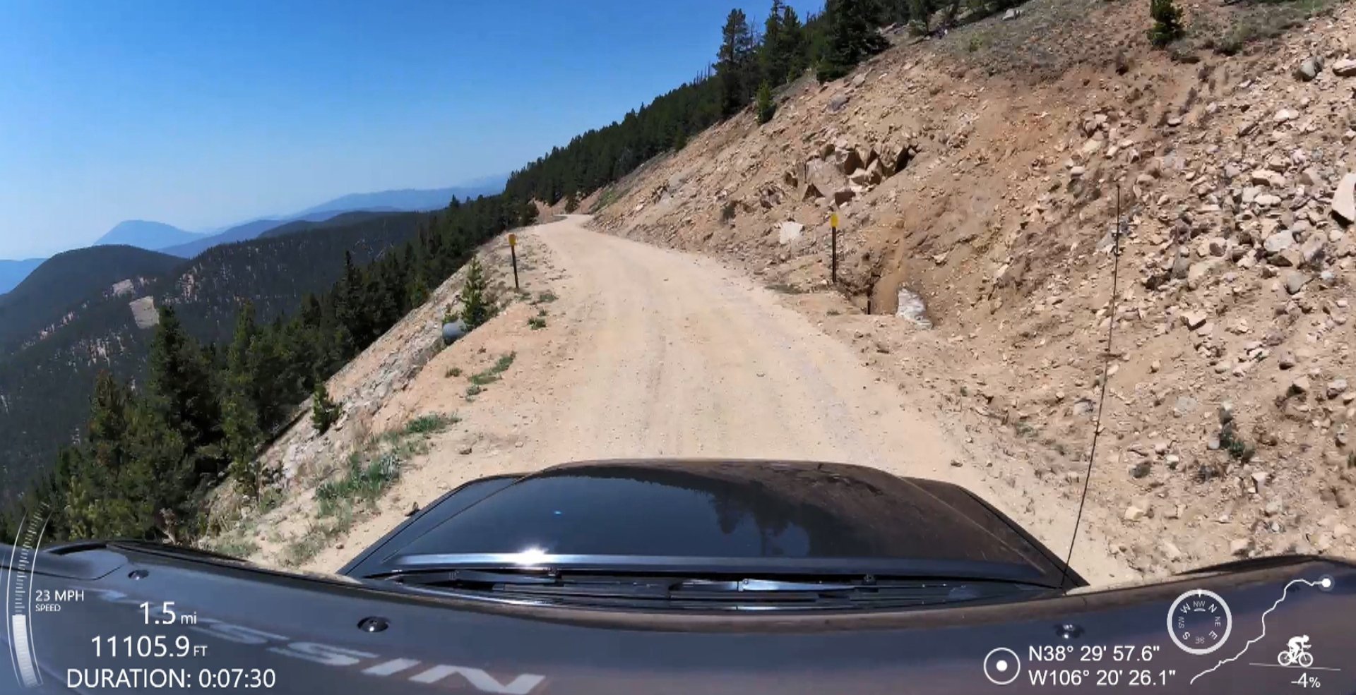
We took this route after finishing The Mule and spending some time in Salida camping on FR 185 Aspen Ridge in the Fourmile Area. A group of Flat Fender Jeeps driven by some friendly people assembled at our campsite as we were preparing to leave, here’s a video, it was a real treat. Most of this route is along excellent dirt roads, and it begins at mile 0 off Monarch Pass. Less than 12 miles are on pavement and 10 of those are at the end. Old Monarch Pass is the only intimidating shelf road on this route, and for Colorado it’s not too bad. The narrow section comes at about 1.5 miles and doesn’t last long- look at the video below, it’s the thumbnail. The scenery along the whole route is fantastic, and there is a lot of camping. The best camping is along Cebolla Creek, which is possibly the most beautiful section of a beautiful route. We finished this in a day and were setup before nightfall.
Technical:
Start Point: Monarch Pass
End Point: Lake City
Total Mileage: 100.9
Difficulty: Easy
Highest Elevation: 11,162
Season Travelled: Late Summer
Permits Required For: n/a
Delorme Atlas & Gazeteer™ Colorado (in order of route):
p. 59, 69, 68 & 67
Camping:
Fourmile Area
Monarch Park Campground
Cebolla Campground
Hidden Valley Tent Campground
Deer Lakes Campground
Route Video: Los Pinos (youtube)
Old Monarch Pass: 10.9 miles -this is an easy dirt road right off highway 50 at Monarch Pass, with an eye opening shelf section beginning at 1.3 miles which gradually enters a treed area by 3.0 miles. That is the only true shelf section of this entire route. The remaining 7.9 miles wind through beautiful pines with great views all around. Video of this road Old Monarch Pass
FR 888 Tomichi Pass Road: 1.5 miles -a short graded dirt road through a valley in ranch country.
FR 887 Black Sage Pass: 6.8 miles -begins with a gradual climb on an Aspen and Pine tree lined dirt road that opens to a long flat run through a sage covered plateau.
CR 887 Waunita Hot Springs Road: 8.8 miles -follows a fence line past a cattle ranch, a small lake and a few residential properties with amazing long range views. This road is mostly graded.
US Highway 50: .5 miles -pavement
CR 45: .9 miles -graded dirt road with a few residences.
CR 14 PP Razor Creek Dome: 15.5 miles -graded dirt for miles with great visibility. We went 50+ mph in places. Beautiful the whole way, wide open spaces.
CO 114 E: 1.3 miles -pavement
CR NN 14 Cochetopa Dome: 3.4 miles -more beautiful flatitude with ranch and farm properties along the way.
CR KK14 / FR 788 Los Pinos Pass: 23.5 miles -one of the most beautiful dirt roads in Colorado, especially in the fall. It’s similar to CR 14 PP and CR NN14 but there is more water in this area and the forest are lush, the terrain more varied and lovely. Video of this road Los Pinos Pass
CR 50 / FR 788 Cebolla Creek: 15.4 miles -Starts in a gorgeous valley and follows a meandering creek. Historic ranch buildings and current operations line the first few miles, giving way to open areas and established camping along the creek. This is the prettiest section of this route. Video of this road Cebolla Creek Road
CO 149 to Lake City: 10 miles -not in the video, it is a paved highway
Individual Whole Road Video Links:
The Bachelor Loop in Creede:
If you turn left instead of right on 149 at the end of Los Pinos you can go to Creede, a wonderful small town. Just outside of Creede is this excellent loop through mining remnants with historical kiosks and short hikes. It’s short, easy and a lot of fun. Read all about it Bachelor Loop Interpretive Tour
If you’d like to support this site please subscribe to our channel on youtube
Copyright © 2024 All Rights Reserved
All materials on this site are protected by copyright and intellectual property laws and are the property of the Author. You may not reproduce this material on your personal website, blog, social network, or any other online, offline, digital or print resource without permission.
You may only access and download the materials located on ColoradoOverlandRoutes.com for personal, non-commercial use.
